-
Tree at scenic overlook

-
"ALL PETS MUST BE KEPT ON LEASH"

-
Snow around two tree trunks

-
Construction barrel at Manassas rest area

-
Sun through the trees at Manassas rest area

-
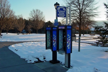
Payphones at New Market rest area

-
Pine needles

-
Interstate 70 Park and Ride [08]
![Interstate 70 Park and Ride [08] (7354 visits) Park and Ride lot at the eastern terminus of Interstate 70, just inside the city limits of Baltimore... Interstate 70 Park and Ride [08]](../../../../i/upload/2024/07/17/20240717101415-dad1f17f-cu_s9999x250.jpg)
-
Interstate 70 Park and Ride [07]
![Interstate 70 Park and Ride [07] (7393 visits) Park and Ride lot at the eastern terminus of Interstate 70, just inside the city limits of Baltimore... Interstate 70 Park and Ride [07]](../../../../i/upload/2024/07/17/20240717101418-cb3d0cab-cu_s9999x250.jpg)
-
View of the Blue Ridge Parkway from Humpback Rock

-
Elsie Manufacturing

-
Couch on a tree stump [01]
![Couch on a tree stump [01] (2134 visits) Couch on a tree stump in front of 4810 Aspen Hill Road in Rockville, Maryland.
Ben Schumin is a pro... Couch on a tree stump [01]](../../../../i/upload/2024/07/17/20240717230925-f9e3f5be-cu_s9999x250.jpg)
-
Couch on a tree stump [02]
![Couch on a tree stump [02] (3095 visits) Couch on a tree stump in front of 4810 Aspen Hill Road in Rockville, Maryland.
Ben Schumin is a pro... Couch on a tree stump [02]](../../../../i/upload/2024/07/17/20240717230928-5c104178-cu_s9999x250.jpg)
-
Ivy rest area [01]
![Ivy rest area [01] (8020 visits) Rest area on Interstate 64 westbound, near Ivy, Virginia (milepost 113).
Ben Schumin is a professio... Ivy rest area [01]](../../../../i/upload/2024/07/17/20240717232803-9c60e629-cu_s9999x250.jpg)
-
Ivy rest area [02]
![Ivy rest area [02] (8111 visits) Rest area on Interstate 64 westbound, near Ivy, Virginia (milepost 113).
Ben Schumin is a professio... Ivy rest area [02]](../../../../i/upload/2024/07/17/20240717232807-2e81efde-cu_s9999x250.jpg)
-
Ivy rest area [03]
![Ivy rest area [03] (7745 visits) Rest area on Interstate 64 westbound, near Ivy, Virginia (milepost 113).
Ben Schumin is a professio... Ivy rest area [03]](../../../../i/upload/2024/07/17/20240717232811-236d66ef-cu_s9999x250.jpg)
 The Quarry Overlook [03]
![The Quarry Overlook [03] (3009 visits) The Quarry Overlook, at milepost 101 on the Blue Ridge Parkway in Botetourt County, Virginia.
Ben S... The Quarry Overlook [03]](../../../../i/upload/2024/07/17/20240717233036-cf4a8757-cu_s9999x250.jpg)
 Downtown Cumberland, Maryland [01]
![Downtown Cumberland, Maryland [01] (3844 visits) Pedestrian mall in downtown Cumberland, Maryland. Three blocks of Baltimore Street were converted t... Downtown Cumberland, Maryland [01]](../../../../i/upload/2024/07/17/20240717233615-1f03e747-cu_s9999x250.jpg)
 Downtown Cumberland, Maryland [02]
![Downtown Cumberland, Maryland [02] (3740 visits) Pedestrian mall in downtown Cumberland, Maryland. Three blocks of Baltimore Street were converted t... Downtown Cumberland, Maryland [02]](../../../../i/upload/2024/07/17/20240717233621-ba0cdbff-cu_s9999x250.jpg)
 Downtown Cumberland, Maryland [03]
![Downtown Cumberland, Maryland [03] (4063 visits) Pedestrian mall in downtown Cumberland, Maryland. Three blocks of Baltimore Street were converted t... Downtown Cumberland, Maryland [03]](../../../../i/upload/2024/07/17/20240717233627-c4337760-cu_s9999x250.jpg)
 Downtown Cumberland, Maryland [04]
![Downtown Cumberland, Maryland [04] (3902 visits) Pedestrian mall in downtown Cumberland, Maryland. Three blocks of Baltimore Street were converted t... Downtown Cumberland, Maryland [04]](../../../../i/upload/2024/07/17/20240717233633-d8fd41b8-cu_s9999x250.jpg)
-
Springer Road in Valley Lee, Maryland

-
Painted branches growing leaves

-
Graffiti-covered tree [01]
![Graffiti-covered tree [01] (7999 visits) Detail of a graffiti-covered tree by the entrance to St. Ignatius Cemetery, near the north end of th... Graffiti-covered tree [01]](../../../../i/upload/2024/07/18/20240718230148-527a7844-cu_s9999x250.jpg)
-
Partially cut tree limb

-
Graffiti-covered tree [02]
![Graffiti-covered tree [02] (5356 visits) Detail of a graffiti-covered tree by the entrance to St. Ignatius Cemetery, near the north end of th... Graffiti-covered tree [02]](../../../../i/upload/2024/07/18/20240718230157-b273d8a3-cu_s9999x250.jpg)
-
Graffiti-covered trees

-
"Stay Out, Stay Alive" sign at Centralia

-
East Village Avenue in snow

-
Water tower at Waldorf Volunteer Fire Department [02]
![Water tower at Waldorf Volunteer Fire Department [02] (2471 visits) Water tower located behind the Waldorf Volunteer Fire Department, off of Old Washington Road in Wald... Water tower at Waldorf Volunteer Fire Department [02]](../../../../i/upload/2024/07/19/20240719104949-33d7c516-cu_s9999x250.jpg)
-
Water tower at Waldorf Volunteer Fire Department [01]
![Water tower at Waldorf Volunteer Fire Department [01] (2631 visits) Water tower located behind the Waldorf Volunteer Fire Department, off of Old Washington Road in Wald... Water tower at Waldorf Volunteer Fire Department [01]](../../../../i/upload/2024/07/19/20240719104954-a43f3235-cu_s9999x250.jpg)
-
East Washington Street and Allawilla Drive [01]
![East Washington Street and Allawilla Drive [01] (3196 visits) Street sign assembly at the intersection of East Washington Street and Allawilla Drive in Charles To... East Washington Street and Allawilla Drive [01]](../../../../i/upload/2024/07/19/20240719105551-a08e131e-cu_s9999x250.jpg)
-
East Washington Street and Allawilla Drive [02]
![East Washington Street and Allawilla Drive [02] (11283 visits) Street sign assembly at the intersection of East Washington Street and Allawilla Drive in Charles To... East Washington Street and Allawilla Drive [02]](../../../../i/upload/2024/07/19/20240719105556-79e2b58f-cu_s9999x250.jpg)
-
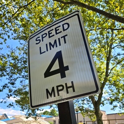
Speed limit 4 mph

-
"WRONG WAY" sign at Devil's Den [02]
!["WRONG WAY" sign at Devil's Den [02] (2460 visits) "WRONG WAY" sign on the parking loop for Devil's Den, near Gettysburg, Pennsylvania.
Ben ... "WRONG WAY" sign at Devil's Den [02]](../../../../i/upload/2024/07/19/20240719112657-4e4c319d-cu_s9999x250.jpg)
-
Brink and Wightman Roads [03]
![Brink and Wightman Roads [03] (2250 visits) Street signs at the intersection of Brink and Wightman Roads near Montgomery Village, Maryland. Thi... Brink and Wightman Roads [03]](../../../../i/upload/2024/07/19/20240719114723-c9ce5756-cu_s9999x250.jpg)
-
Brink and Goshen Roads [03]
![Brink and Goshen Roads [03] (2520 visits) Street signs at the intersection of Brink and Goshen Roads near Montgomery Village, Maryland. This ... Brink and Goshen Roads [03]](../../../../i/upload/2024/07/19/20240719114729-e7321e33-cu_s9999x250.jpg)
-
Brink and Goshen Roads [01]
![Brink and Goshen Roads [01] (2314 visits) Street signs at the intersection of Brink and Goshen Roads near Montgomery Village, Maryland. This ... Brink and Goshen Roads [01]](../../../../i/upload/2024/07/19/20240719114734-e7a24e73-cu_s9999x250.jpg)
-
Brink and Goshen Roads [06]
![Brink and Goshen Roads [06] (2274 visits) Street signs at the intersection of Brink and Goshen Roads near Montgomery Village, Maryland. This ... Brink and Goshen Roads [06]](../../../../i/upload/2024/07/19/20240719114740-26c54d48-cu_s9999x250.jpg)
-
Brink and Goshen Roads [09]
![Brink and Goshen Roads [09] (2389 visits) Street signs at the intersection of Brink and Goshen Roads near Montgomery Village, Maryland. This ... Brink and Goshen Roads [09]](../../../../i/upload/2024/07/19/20240719114745-0abbecd0-cu_s9999x250.jpg)
-
Brink and Wightman Roads [02]
![Brink and Wightman Roads [02] (2122 visits) Street signs at the intersection of Brink and Wightman Roads near Montgomery Village, Maryland. Thi... Brink and Wightman Roads [02]](../../../../i/upload/2024/07/19/20240719114750-44efa94d-cu_s9999x250.jpg)
-
Brink and Goshen Roads [02]
![Brink and Goshen Roads [02] (2234 visits) Street signs at the intersection of Brink and Goshen Roads near Montgomery Village, Maryland. This ... Brink and Goshen Roads [02]](../../../../i/upload/2024/07/19/20240719114755-96e78db3-cu_s9999x250.jpg)
-
Brink and Goshen Roads [07]
![Brink and Goshen Roads [07] (2268 visits) Street signs at the intersection of Brink and Goshen Roads near Montgomery Village, Maryland. This ... Brink and Goshen Roads [07]](../../../../i/upload/2024/07/19/20240719114800-f7779954-cu_s9999x250.jpg)
-
Brink and Goshen Roads [10]
![Brink and Goshen Roads [10] (2325 visits) Street signs at the intersection of Brink and Goshen Roads near Montgomery Village, Maryland. This ... Brink and Goshen Roads [10]](../../../../i/upload/2024/07/19/20240719114805-de066605-cu_s9999x250.jpg)
-
Brink and Wightman Roads [01]
![Brink and Wightman Roads [01] (2320 visits) Street signs at the intersection of Brink and Wightman Roads near Montgomery Village, Maryland. Thi... Brink and Wightman Roads [01]](../../../../i/upload/2024/07/19/20240719114814-00630fe7-cu_s9999x250.jpg)
-
Brink and Goshen Roads [04]
![Brink and Goshen Roads [04] (2303 visits) Street signs at the intersection of Brink and Goshen Roads near Montgomery Village, Maryland. This ... Brink and Goshen Roads [04]](../../../../i/upload/2024/07/19/20240719114820-366f383a-cu_s9999x250.jpg)
-
Brink and Goshen Roads [05]
![Brink and Goshen Roads [05] (2283 visits) Street signs at the intersection of Brink and Goshen Roads near Montgomery Village, Maryland. This ... Brink and Goshen Roads [05]](../../../../i/upload/2024/07/19/20240719114825-4168906a-cu_s9999x250.jpg)
-
Brink and Goshen Roads [08]
![Brink and Goshen Roads [08] (2454 visits) Street signs at the intersection of Brink and Goshen Roads near Montgomery Village, Maryland. This ... Brink and Goshen Roads [08]](../../../../i/upload/2024/07/19/20240719114830-a81c39b1-cu_s9999x250.jpg)
-
Buckingham Branch locomotive 13 [02]
![Buckingham Branch locomotive 13 [02] (2712 visits) Buckingham Branch locomotive 13, waiting on a track near downtown Staunton, Virginia. Buckingham Br... Buckingham Branch locomotive 13 [02]](../../../../i/upload/2024/07/19/20240719125834-6d066106-cu_s9999x250.jpg)
-
Buckingham Branch locomotive 13 [03]
![Buckingham Branch locomotive 13 [03] (3393 visits) Buckingham Branch locomotive 13, waiting on a track near downtown Staunton, Virginia. Buckingham Br... Buckingham Branch locomotive 13 [03]](../../../../i/upload/2024/07/19/20240719125840-e3634df1-cu_s9999x250.jpg)
-
Buckingham Branch locomotive 13 [01]
![Buckingham Branch locomotive 13 [01] (2639 visits) Buckingham Branch locomotive 13, waiting on a track near downtown Staunton, Virginia. Buckingham Br... Buckingham Branch locomotive 13 [01]](../../../../i/upload/2024/07/19/20240719125922-4d3c6317-cu_s9999x250.jpg)
-
Interstate 76 sign on Green Lane Bridge

-
Stop sign at Warrenton Volunteer Fire Company

-
View down Lew Dewitt Boulevard

-
Aerial view of Glen Burnie, Maryland [01]
![Aerial view of Glen Burnie, Maryland [01] (3120 visits) Aerial view of Glen Burnie, Maryland, taken near Marley Station Mall.
Ben Schumin is a professional... Aerial view of Glen Burnie, Maryland [01]](../../../../i/upload/2024/07/19/20240719162345-6a1470e1-cu_s9999x250.jpg)
-
Aerial view of Glen Burnie, Maryland [02]
![Aerial view of Glen Burnie, Maryland [02] (3033 visits) Aerial view of Glen Burnie, Maryland, taken near Marley Station Mall.
Ben Schumin is a professional... Aerial view of Glen Burnie, Maryland [02]](../../../../i/upload/2024/07/19/20240719162350-5a3dcd0c-cu_s9999x250.jpg)
-
Harrisonburg east of Route 33

-
Buffalo Gap [01]
![Buffalo Gap [01] (3208 visits) Buffalo Gap, a mountain pass through Little North Mountain, near Swoope, Virginia.
Ben Schumin is... Buffalo Gap [01]](../../../../i/upload/2024/07/19/20240719164455-62064f1c-cu_s9999x250.jpg)
-
Faded stop sign [01]
![Faded stop sign [01] (2738 visits) A very faded stop sign at the end of an access road for several businesses at the intersection with ... Faded stop sign [01]](../../../../i/upload/2024/07/19/20240719164633-3746ed7c-cu_s9999x250.jpg)
-
Faded stop sign [02]
![Faded stop sign [02] (2690 visits) A very faded stop sign at the end of an access road for several businesses at the intersection with ... Faded stop sign [02]](../../../../i/upload/2024/07/19/20240719164638-c40f7dea-cu_s9999x250.jpg)
-
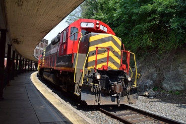
Buckingham Branch locomotive 5 at Staunton Amtrak station

-
Sunset near Gettysburg, Pennsylvania [01]
![Sunset near Gettysburg, Pennsylvania [01] (2815 visits) Sunset over fields along US 15 business near Gettysburg, Pennsylvania. The air was a bit hazy on th... Sunset near Gettysburg, Pennsylvania [01]](../../../../i/upload/2024/07/19/20240719170930-530c41ea-cu_s9999x250.jpg)
-
Sunset near Gettysburg, Pennsylvania [02]
![Sunset near Gettysburg, Pennsylvania [02] (2877 visits) Sunset over fields along US 15 business near Gettysburg, Pennsylvania. The air was a bit hazy on th... Sunset near Gettysburg, Pennsylvania [02]](../../../../i/upload/2024/07/19/20240719170934-9483611c-cu_s9999x250.jpg)
-
DoubleTree Hotel in Charlottesville, Virginia [01]
![DoubleTree Hotel in Charlottesville, Virginia [01] (4817 visits) DoubleTree Hotel on Hilton Heights Road in Charlottesville, Virginia. This hotel was built in 1984,... DoubleTree Hotel in Charlottesville, Virginia [01]](../../../../i/upload/2024/07/19/20240719171742-a365fe34-cu_s9999x250.jpg)
-
Waynesboro, Virginia, facing approximately east

-
Linkythorn Lane

-
Interstate 95 at Patuxent River

-
Interstate 95 at Brooklyn Bridge Road [01]
![Interstate 95 at Brooklyn Bridge Road [01] (2576 visits) Interstate 95 at Brooklyn Bridge Road in Laurel, Maryland.
Ben Schumin is a professional photograph... Interstate 95 at Brooklyn Bridge Road [01]](../../../../i/upload/2024/07/19/20240719212319-81fd1a30-cu_s9999x250.jpg)
-
Interstate 95 at Brooklyn Bridge Road [03]
![Interstate 95 at Brooklyn Bridge Road [03] (4238 visits) Interstate 95 at Brooklyn Bridge Road in Laurel, Maryland.
Ben Schumin is a professional photograph... Interstate 95 at Brooklyn Bridge Road [03]](../../../../i/upload/2024/07/19/20240719212324-de677956-cu_s9999x250.jpg)
-
Interstate 95 at Brooklyn Bridge Road [02]
![Interstate 95 at Brooklyn Bridge Road [02] (2667 visits) Interstate 95 at Brooklyn Bridge Road in Laurel, Maryland.
Ben Schumin is a professional photograph... Interstate 95 at Brooklyn Bridge Road [02]](../../../../i/upload/2024/07/19/20240719212350-10f37ba8-cu_s9999x250.jpg)
-
2900 block of Atlantic Avenue

-
Interstate 81 at Route 796 [02]
![Interstate 81 at Route 796 [02] (4664 visits) Interstate 81 near Mount Jackson, Virginia, at the point where State Route 796 (Hawkins Road) crosse... Interstate 81 at Route 796 [02]](../../../../i/upload/2024/07/20/20240720020830-706bf71d-cu_s9999x250.jpg)
-
Interstate 81 at Route 796 [01]
![Interstate 81 at Route 796 [01] (4593 visits) Interstate 81 near Mount Jackson, Virginia, at the point where State Route 796 (Hawkins Road) crosse... Interstate 81 at Route 796 [01]](../../../../i/upload/2024/07/20/20240720020902-02c4ce7b-cu_s9999x250.jpg)
-
Neighborhood in Clifton Forge, Virginia [01]
![Neighborhood in Clifton Forge, Virginia [01] (1932 visits) Aerial view of a neighborhood in Clifton Forge, Virginia, near downtown.
Ben Schumin is a professio... Neighborhood in Clifton Forge, Virginia [01]](../../../../i/upload/2024/07/20/20240720021719-e5828a4e-cu_s9999x250.jpg)
-
Neighborhoods in Covington, Virginia

-
Snow-covered mileage sign on US 250

-
Snow-covered speed limit sign on US 250

-
West Broad Street at Staples Mill Road [01]
![West Broad Street at Staples Mill Road [01] (4744 visits) Aerial view of West Broad Street at the intersection with Staples Mill Road in Richmond, Virginia. ... West Broad Street at Staples Mill Road [01]](../../../../i/upload/2024/07/20/20240720091824-c8526d69-cu_s9999x250.jpg)
-
West Broad Street at Staples Mill Road [02]
![West Broad Street at Staples Mill Road [02] (74521 visits) Aerial view of West Broad Street at the intersection with Staples Mill Road in Richmond, Virginia. ... West Broad Street at Staples Mill Road [02]](../../../../i/upload/2024/07/20/20240720092012-1df12de7-cu_s9999x250.jpg)
-
Small island in the James River
